
Latest Version
Update
February 01, 2025
February 01, 2025
Developer
Iterum, LLC
Iterum, LLC
Categories
Maps & Navigation
Maps & Navigation
Platforms
Android
Android
Downloads
0
0
License
$12.99
$12.99
Package Name
com.iterum.wbsa
com.iterum.wbsa
Report
Report a Problem
Report a Problem
More About Wasatch Backcountry Skiing Map
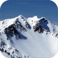
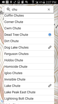
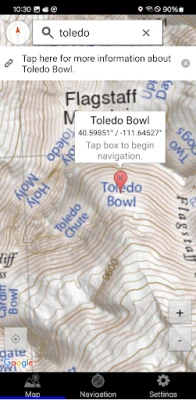
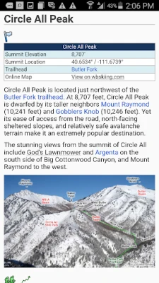
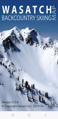
The Wasatch Backcountry Skiing Map (WBSkiing) is the Android version of the popular paper map and website (see https://WBSkiing.com). As with the other platforms, the Android map includes an index to more than 1,000 backcountry locations in Utah’s Central Wasatch mountains. It is the must-have map for Utah hikers and backcountry travelers.
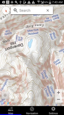
With a familiar interface, the Wasatch Backcountry Skiing Map accesses your device’s GPS to display your current location on a high-resolution topo map. And with only a few taps, the “destination arrow” on the integrated compass will point to your desired backcountry ski location. The map has "reddish" shading on slopes that are approximately 30 degrees or steeper. This shading will help you reduce your exposure when in avalanche terrain.
The app also displays your current elevation, latitude/longitude, and will send your current location via email. The app also links more than 200 of the locations to https://wbsguide.com where you can learn about the skiing difficulty, skinning distance, vertical climb, parking considerations, and more.
You do not need to have cell service to use this app--you don't even need a contract with a cell service provider.
If you encounter a problem with this app, PLEASE contact me using the support link (or via https://WBSkiing.com) before leaving a negative review.
Rate the App
Add Comment & Review
User Reviews
Based on 0 reviews
No reviews added yet.
Comments will not be approved to be posted if they are SPAM, abusive, off-topic, use profanity, contain a personal attack, or promote hate of any kind.


More »

Popular Apps

phpFoxPHPFOX LLC

Moon Chai StoryOlha Dobel

World War Heroes — WW2 PvP FPSAzur Interactive Games Limited

Govee LiteGovee
Build World AdventureExplore city in cube world

Viking Clan: RagnarokKano Games

Vikings: War of ClansPlarium LLC

Submarine Car Diving SimulatorSwim with dolphins & penguins

Asphalt 9: LegendsGameloft SE
Dawn of Zombies: Survival GameRoyal Ark
More »
Editor's Choice

Grim Soul: Dark Survival RPGBrickworks Games Ltd

Craft of Survival - Gladiators101XP LIMITED

Last Shelter: SurvivalLong Tech Network Limited
Dawn of Zombies: Survival GameRoyal Ark

Merge Survival : WastelandStickyHands Inc.

AoD Vikings: Valhalla GameRoboBot Studio
Viking Clan: RagnarokKano Games
Vikings: War of ClansPlarium LLC
Asphalt 9: LegendsGameloft SE

Modern Tanks: War Tank GamesXDEVS LTD