


Latest Version
Update
June 15, 2026
June 15, 2026
Developer
APPNEST.live
APPNEST.live
Categories
Tools
Tools
Platforms
Android
Android
Downloads
0
0
License
Free
Free
Package Name
com.landsurveyor
com.landsurveyor
Report
Report a Problem
Report a Problem
More About Land Surveyor
Land Surveyor — Professional Surveying Toolkit
The ultimate surveying companion for land surveyors, civil engineers, and construction professionals. Land Surveyor delivers a complete suite of field-ready tools, advanced calculations, and high-accuracy GPS capabilities — now rebuilt natively in Kotlin for blazing-fast performance, lower battery use, and a smoother, more reliable experience on every Android device.
✨ AD-FREE EXPERIENCE
• One-time in-app purchase to permanently remove all ads
• Clean, distraction-free professional workflow
• No subscriptions — pay once, enjoy forever
📸 PHOTO ANNOTATION
• Capture GPS-tagged photos with coordinates
• Add labels, notes, and annotations
• Organize by projects
• Full-screen viewing with metadata
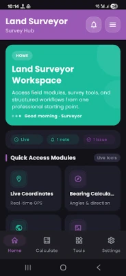
📍 GPS & LIVE COORDINATES
• Real-time GPS tracking in UTM and spherical coordinates
• High-accuracy position monitoring
• Export coordinates to Excel and PDF
• Track movement history
• Visual map integration
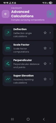
🧮 ADVANCED CALCULATIONS (15+ Tools)
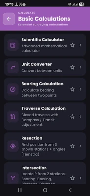
• Bearing calculations between points
• Traverse computations with closure analysis
• Resection and intersection calculations
• Curve calculations (horizontal, vertical, transition)
• Triangle area and perimeter
• Deflection angle calculations
• Slope distance and elevation
• Scale factor calculations
• Interpolation tools
🛠️ PROFESSIONAL TOOLS (25+)
• Digital compass for navigation
• Level book generator with auto-calc
• Leveling loop adjustment
• Scientific calculator
• Unit converter
• Quick reference guide
• Solar Position Calculator
• GNSS Forecast & Planning
🗺️ COORDINATE TOOLS
• UTM ↔ Lat/Lon conversion with zone support
• UTM Zone Converter
• Decimal ↔ DMS conversion (single & batch)
• EPSG Coordinate Transformations
• Oman (ONG), Qatar (QND), Saudi Arabia conversions
• Global 2D Helmert transformation
• Height & geoid undulation
• KML/KMZ file viewer
📐 CURVE & ELEVATION
• Horizontal curves (simple, compound, spiral)
• Vertical curves (crest, sag, unsymmetric)
• Super elevation calculations
• Circular layout
• Create points on lines and curves
📊 DATA MANAGEMENT
• Project notes with checklists
• Export results to Excel and PDF
• Import/export data
• Share files easily
• Organize work by projects
🎯 SPECIALIZED FEATURES
• KSA Control Points map
• Precision and accuracy calculators
• Stakeout coordinate tools
• Measure distances
• Coordinate intersection
• Perpendicular line calculations
• Benchmark Navigation Pro with cloud jobs and CSV import
💡 KEY FEATURES
• Clean, professional design
• Native Kotlin performance
• Fast launch and instant screen transitions
• Intuitive navigation
🤖 AI ASSISTANT
Get instant, intelligent help with any surveying tool. Ask questions in plain English and receive step-by-step guidance.
(Requires OpenAI API key. Standard usage charges apply.)
AI Features:
✓ Context-aware help
✓ Natural language questions
✓ Step-by-step instructions
✓ Best practices
✓ Formula explanations
🌍 PERFECT FOR:
✓ Land surveyors
✓ Civil engineers
✓ Site engineers
✓ Property boundary surveys
✓ Construction layout
✓ Topographic surveys
✓ GPS data collection
Land Surveyor combines powerful professional tools for field and office work to deliver accurate results — fast, smooth, and reliable.
Download now and transform your surveying workflow!
Official apps by APPNEST
🌐 https://appnest.live
✨ AD-FREE EXPERIENCE
• One-time in-app purchase to permanently remove all ads
• Clean, distraction-free professional workflow
• No subscriptions — pay once, enjoy forever
📸 PHOTO ANNOTATION
• Capture GPS-tagged photos with coordinates
• Add labels, notes, and annotations
• Organize by projects
• Full-screen viewing with metadata
📍 GPS & LIVE COORDINATES
• Real-time GPS tracking in UTM and spherical coordinates
• High-accuracy position monitoring
• Export coordinates to Excel and PDF
• Track movement history
• Visual map integration
🧮 ADVANCED CALCULATIONS (15+ Tools)
• Bearing calculations between points
• Traverse computations with closure analysis
• Resection and intersection calculations
• Curve calculations (horizontal, vertical, transition)
• Triangle area and perimeter
• Deflection angle calculations
• Slope distance and elevation
• Scale factor calculations
• Interpolation tools
🛠️ PROFESSIONAL TOOLS (25+)
• Digital compass for navigation
• Level book generator with auto-calc
• Leveling loop adjustment
• Scientific calculator
• Unit converter
• Quick reference guide
• Solar Position Calculator
• GNSS Forecast & Planning
🗺️ COORDINATE TOOLS
• UTM ↔ Lat/Lon conversion with zone support
• UTM Zone Converter
• Decimal ↔ DMS conversion (single & batch)
• EPSG Coordinate Transformations
• Oman (ONG), Qatar (QND), Saudi Arabia conversions
• Global 2D Helmert transformation
• Height & geoid undulation
• KML/KMZ file viewer
📐 CURVE & ELEVATION
• Horizontal curves (simple, compound, spiral)
• Vertical curves (crest, sag, unsymmetric)
• Super elevation calculations
• Circular layout
• Create points on lines and curves
📊 DATA MANAGEMENT
• Project notes with checklists
• Export results to Excel and PDF
• Import/export data
• Share files easily
• Organize work by projects
🎯 SPECIALIZED FEATURES
• KSA Control Points map
• Precision and accuracy calculators
• Stakeout coordinate tools
• Measure distances
• Coordinate intersection
• Perpendicular line calculations
• Benchmark Navigation Pro with cloud jobs and CSV import
💡 KEY FEATURES
• Clean, professional design
• Native Kotlin performance
• Fast launch and instant screen transitions
• Intuitive navigation
🤖 AI ASSISTANT
Get instant, intelligent help with any surveying tool. Ask questions in plain English and receive step-by-step guidance.
(Requires OpenAI API key. Standard usage charges apply.)
AI Features:
✓ Context-aware help
✓ Natural language questions
✓ Step-by-step instructions
✓ Best practices
✓ Formula explanations
🌍 PERFECT FOR:
✓ Land surveyors
✓ Civil engineers
✓ Site engineers
✓ Property boundary surveys
✓ Construction layout
✓ Topographic surveys
✓ GPS data collection
Land Surveyor combines powerful professional tools for field and office work to deliver accurate results — fast, smooth, and reliable.
Download now and transform your surveying workflow!
Official apps by APPNEST
🌐 https://appnest.live
Rate the App
Add Comment & Review
User Reviews
Based on 0 reviews
No reviews added yet.
Comments will not be approved to be posted if they are SPAM, abusive, off-topic, use profanity, contain a personal attack, or promote hate of any kind.


More »

Popular Apps

phpFoxPHPFOX LLC

Moon Chai StoryOlha Dobel

World War Heroes — WW2 PvP FPSAzur Interactive Games Limited

Govee LiteGovee

Build World AdventureExplore city in cube world

Viking Clan: RagnarokKano Games

Vikings: War of ClansPlarium LLC

Asphalt 9: LegendsGameloft SE

Submarine Car Diving SimulatorSwim with dolphins & penguins

Dawn of Zombies: Survival GameRoyal Ark
More »
Editor's Choice

Grim Soul: Dark Survival RPGBrickworks Games Ltd

Craft of Survival - Gladiators101XP LIMITED

Last Shelter: SurvivalLong Tech Network Limited
Dawn of Zombies: Survival GameRoyal Ark

Merge Survival : WastelandStickyHands Inc.

AoD Vikings: Valhalla GameRoboBot Studio
Viking Clan: RagnarokKano Games
Vikings: War of ClansPlarium LLC
Asphalt 9: LegendsGameloft SE

Modern Tanks: War Tank GamesXDEVS LTD